When planning a project, some areas are simply off-limits.
Highways, pipelines, substations, or airports—these types of infrastructure often require buffer zones. Whether it's for safety, regulations, or just good practice, you need to avoid building too close.
That’s where exclusion zones come in.
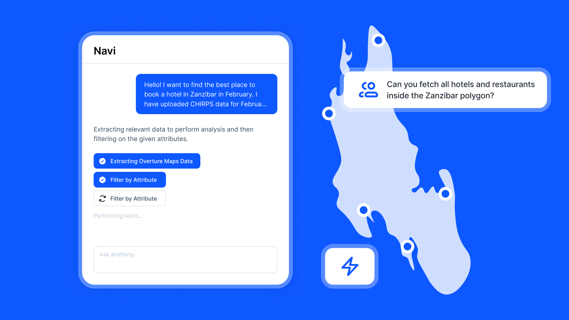
With Atlas, you can draw these zones easily and visually. You start with a line or point, set your distance, and generate a buffer. It becomes an exclusion layer you can use to screen out land or guide your layout.
Here’s how to draw exclusion zones around infrastructure on a map.
What Are Exclusion Zones?
An exclusion zone is a no-go area you draw around something important.
These buffers help you meet planning requirements and avoid risky locations.
Step 1: Add Infrastructure to Your Map
Before you can draw around infrastructure, you need to see it on the map.
You can:
- Use the OpenStreetMap integration to add roads, rail, power lines, and substations
- Upload shapefiles or CSVs with infrastructure points or lines
- Draw infrastructure manually using Atlas’ line and point tools
Once added, make sure the data is labeled clearly (e.g. “Substations”, “Gas Pipelines”).
Step 2: Use the Buffer Tool
To create the exclusion zone:
- Select the Buffer Tool from the vector operations
- Choose your infrastructure layer as the input
- Set the buffer distance (e.g. 100m)
- Choose the unit (meters or kilometers)
- Run the tool
Atlas will create a new polygon layer—your exclusion zone.
Also read: How to buffer a site by 500m
Step 3: Style the Exclusion Zone
Give your exclusion zone a clear visual style so it’s easy to spot.
Use:
- A light red or orange fill color
- Semi-transparent opacity
- No label (optional)
- A bold outline
This helps everyone know: don’t build here.
Step 4: Overlay Parcels or Project Boundaries
Now bring in the land you’re evaluating.
You can:
- Upload parcel data from a CSV or shapefile
- Draw project boundaries manually
- Add site candidates from earlier work
Now the map shows both what you want to build—and what you need to avoid.
Step 5: Filter or Flag Overlapping Sites
To check which parcels fall into the exclusion zone:
- Use the Intersect Tool to find overlaps
- Tag or label parcels as “Excluded” if they fall inside
- Filter or hide them to clean up your view
You can also export a filtered list showing only parcels outside the exclusion zone—ready for the next step in your process.
Step 6: Share or Export
Once your exclusion zone is drawn and applied:
- Share the live map with your team or client
- Export the exclusion zone as GeoJSON or shapefile
- Save the view with layers and filters for meetings or reports
Everyone stays on the same page.
Use Cases
Exclusion zones are useful for:
- Solar and wind developers working near grid lines
- Battery and storage teams avoiding restricted areas
- Urban planners managing road and airport buffers
- Consultants helping clients meet permitting rules
They’re one of the most reliable tools for early-stage site screening.
Tips
- Run multiple buffers if you have different distances for different features
- Use comments to explain why zones exist
- Combine with environmental constraint layers for a full site risk profile
- Save versions for comparison (e.g. 100m vs 150m buffers)
A clean exclusion zone saves time—and avoids future problems.
Site Search and Evaluation with Atlas
Like most GIS platforms, Atlas can help you look at maps. But when it comes to site search and evaluation, Atlas goes much further.
It’s built specifically for people who need to spot the right land, fast.
Whether you’re scouting for renewable energy projects, industrial expansions, new retail locations, or land investment opportunities—Atlas gives you the tools to compare parcels, overlay key data, and share results with your team.
This isn’t just about seeing what’s on a map. It’s about making a decision.
Let’s break down how Atlas helps you find and evaluate sites more efficiently.
Bring Your Own Data or Start From What’s Built In
Sometimes you already have a list of parcels. Other times you’re starting from scratch.
Atlas works well in both cases.
Upload a CSV with parcel data, or drop in shapefiles from your GIS team. You can also use drawing tools to sketch out potential sites manually. Each shape becomes a layer you can click, label, and filter.
But if you don’t have data, no problem.
Layer Key Data to Evaluate Site Potential
This is where Atlas stands out.
Instead of flipping between different platforms to compare slope, access, zoning, and flood risk—you just layer it all on the same map.
You can:
- Add flood zone shapefiles
- Import elevation and run Slope Analysis
- Draw buffers around power lines or roads
- Overlay wind speed rasters and compare to parcels
- Tag constraints like wetlands or protected areas
Each layer is styled visually—so you can color, label, and toggle visibility depending on what you need to see.
That means less time guessing, and more time seeing.
Also read: Best Way to Map Flood Risk for Development
Style, Filter, and Compare Sites Fast
Atlas makes it easy to surface the parcels that matter.
Need to find all land within 1km of a substation and outside the flood zone and with a slope under 10%?
No problem.
You can filter by overlap, intersect layers, or use visual styling (like heatmaps or range coloring) to compare sites at a glance. This helps you narrow down dozens or hundreds of parcels into a shortlist—based on your actual criteria.
It’s the kind of analysis that would take hours in traditional GIS tools. In Atlas, it’s built in.
Save Views, Share Maps, and Move Quickly
Once you’ve identified viable sites, you don’t want to waste time copying screenshots into slides.
Just share a live map.
Atlas lets you save views with specific layers turned on, annotate them with labels or comments, and export the results as PDFs, images, or shareable links. Your team sees exactly what you see.
Clients, engineers, or investors can explore the map in real-time—without needing a login or software.
Real Teams Use It This Way Every Day
Atlas is used by solar developers, land acquisition teams, consultants, and manufacturers across industries.
They’re using it to:
- Evaluate wind and solar potential
- Compare parcels for land deals
- Screen out sites with slope, flood, or zoning issues
- Plan for infrastructure access
- Report site findings to partners and clients
In short, if your job involves picking land or comparing locations—Atlas makes it easier.
Smarter Site Search Starts with the Right Tools
You don’t need to be a GIS expert to evaluate land like one.
Atlas takes the tools that used to be hidden behind complicated software and makes them available right in the browser.
So whether you’re screening 10 parcels or 1,000, you can see the data clearly, layer what matters, and share results in minutes—not days.
Flood zones? Check. Slope? Done. Proximity to grid? Covered. Team visibility? One link.
That’s what modern site evaluation looks like in Atlas.
Boost Your Workflow with the Right Tools
Site planning moves fast. Whether you're checking slope, flood zones, proximity to power lines, or wind potential—speed and clarity matter.
Atlas gives you both.
In this article, we covered how to draw exclusion zones around infrastructure, but that’s just one of many things you can do with Atlas.
From overlaying data to running analysis, styling layers, and sharing maps with your team, Atlas makes complex site evaluation tasks simple and visual. All from your browser. No GIS experience needed.
So whether you're screening parcels, comparing risk, or narrowing down locations, Atlas helps you move from "just looking" to "let’s go" faster.
Sign up for free or book a walkthrough today.