In an era marked by heightened environmental awareness and a growing need for sustainable solutions, access to accurate and up-to-date environmental data is crucial.
Whether you're a researcher, policymaker, student, or simply an environmentally conscious individual, having reliable information at your fingertips can drive informed decision-making and contribute to positive ecological outcomes. Fortunately, the digital age has ushered in an era of unprecedented access to data, and a plethora of free resources now exist for obtaining valuable environmental information.
In this article, we will explore a curated selection of these free data sources for environmental data, providing a comprehensive guide for those seeking to delve into the wealth of information available on our planet's ecosystems, climate, and overall environmental health.
From climate patterns to biodiversity metrics, this compilation aims to empower users with the tools they need to better understand and address pressing environmental challenges.
What is Environmental Data
Environmental data is related to the Earth's ecosystems, climate, and natural resources.
This data can be quantitative or qualitative, ranging from atmospheric conditions and biodiversity indices to pollution levels and land use patterns.
At its core, environmental data is a vital tool for understanding the state of our planet and the impacts of human actions on the environment. Scientists, policymakers, researchers, and the general public rely on this information to make informed decisions that promote sustainability, conservation, and the overall well-being of ecosystems.
Key categories of environmental data include:
-
Climate Data: This category includes temperature, precipitation, humidity, wind patterns, and other atmospheric conditions. Long-term climate data is crucial for tracking trends, identifying climate change impacts, and formulating strategies to mitigate environmental risks.
-
Biodiversity Data: Biodiversity data provides insights into the variety of plant and animal species within specific ecosystems. It includes information on species distribution, population dynamics, and genetic diversity. Understanding biodiversity is essential for ecosystem management and conservation efforts.
-
Air and Water Quality Data: Monitoring the quality of air and water is crucial for assessing environmental health. Data in this category often includes measurements of pollutants, such as particulate matter, ozone, nitrogen dioxide, and various contaminants in water bodies.
-
Land Use and Land Cover Data: This type of data describes the way land is utilized and the composition of its surface, including forests, urban areas, agricultural land, and more. Monitoring changes in land use and land cover is essential for sustainable land management.
-
Environmental Monitoring Data: This encompasses a broad range of measurements, from the health of ecosystems to the impact of human activities. Examples include soil quality, wildlife tracking, and the monitoring of deforestation rates.
Let's delve into the collection of free data sources for environmental data!
Accessible and reliable environmental data is the cornerstone of informed decision-making and effective environmental stewardship.
Global Data
From climate patterns and renewable energy potentials to broader environmental insights, these sources provide a comprehensive view that transcends geographical boundaries.
In this section, we explore key global sources for environmental data, each serving information about planet's ecosystems, climate, and resources.
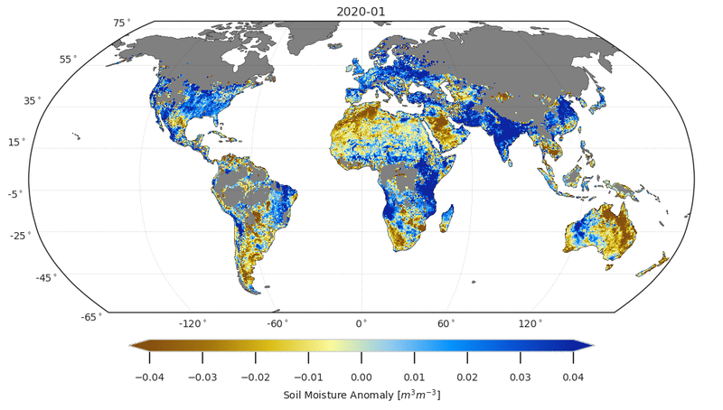
WorldClim
WorldClim stands as a pivotal resource of environmental data, offering accessible and comprehensive global climate information.
Developed by the WorldClim project, this platform collects data from diverse sources, employing advanced statistical methods to produce finely detailed climate surfaces. With coverage spanning historical records and future projections, WorldClim provides crucial insights into temperature and precipitation patterns.
Widely utilized across disciplines, from ecology to agriculture, the platform's gridded datasets empower researchers and decision-makers to enhance the accuracy of their analyses, contributing to a deeper understanding of climate trends and supporting efforts to address environmental challenges on a global scale.
The commitment to free and open access underscores WorldClim's role in democratizing climate information for the benefit of a more informed and environmentally conscious society.

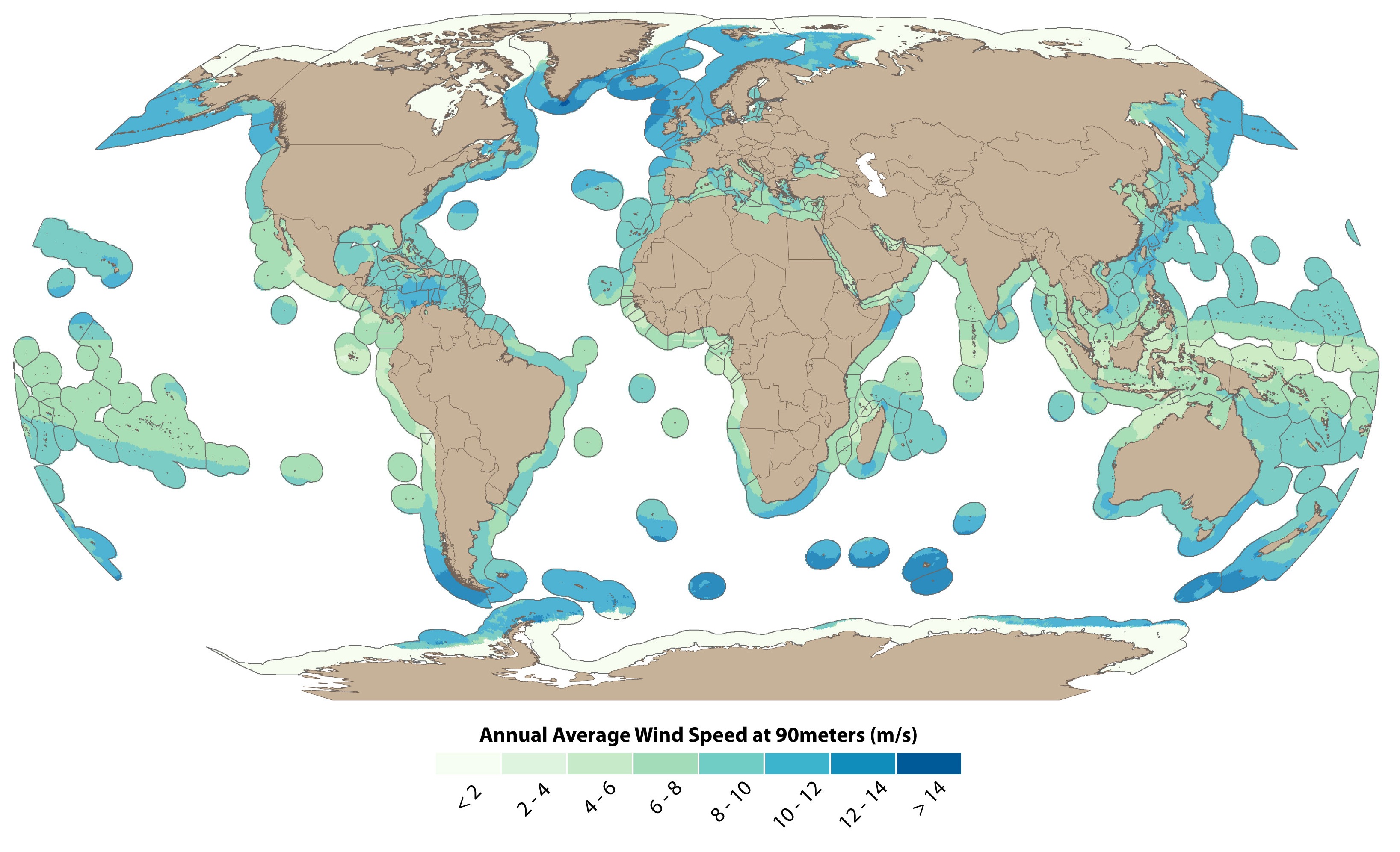
Global Solar Atlas
The Global Solar Atlas serves as an invaluable resource for those exploring the possibilities of renewable energy.
Developed by the World Bank Group, this online platform offers access to high-resolution solar resource data globally. It provides solar radiation and photovoltaic power potential information, aiding decision-makers, researchers, and solar energy enthusiasts in assessing the feasibility and efficiency of solar projects.
The platform not only facilitates strategic planning for sustainable energy initiatives but also empowers communities and businesses to harness the abundant power of the sun. As the world increasingly transitions towards clean energy solutions, the Global Solar Atlas emerges as a beacon, guiding stakeholders towards a more sustainable and solar-powered future.
Also, Global Wind Atlas is a great source for wind data!

OpenEI
OpenEI stands at the forefront of democratizing access to crucial energy-related data.
As an online platform supported by the National Renewable Energy Laboratory (NREL), OpenEI provides an extensive repository of open data, tools, and resources related to energy production, consumption, and efficiency.
Covering a wide spectrum of energy topics, from renewable resources to market trends, OpenEI empowers researchers, policymakers, and innovators to make informed decisions in the pursuit of sustainable energy solutions.
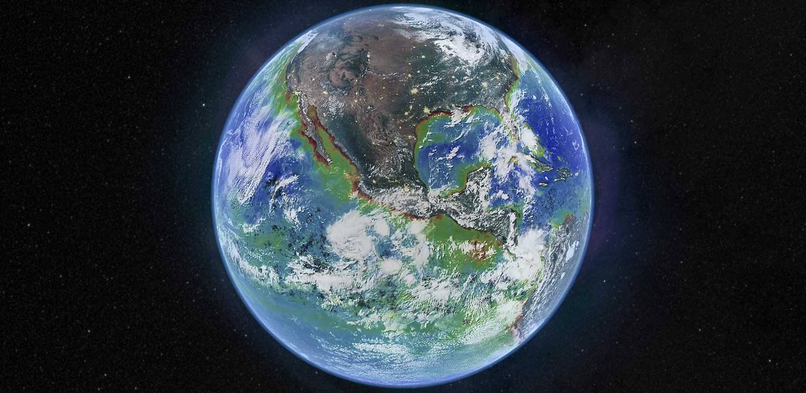
NASA Earth Observing System Data and Information System (EOSDIS)
The NASA Earth Observing System Data and Information System (EOSDIS) stands as a cornerstone for accessing satellite-based data on Earth's intricate and dynamic systems.
Developed by NASA, EOSDIS collates and disseminates information obtained from a diverse array of Earth-observing satellites, providing a comprehensive understanding of the planet's climate, atmosphere, land, and oceans.
Researchers and scientists worldwide leverage this robust data system to study phenomena such as climate change, natural disasters, and ecosystem dynamics.
OpenWeatherMap
OpenWeatherMap emerges as a vital data source in the realm of meteorology, providing real-time and forecasted weather data to a diverse range of users.
It offers accessible and reliable weather information, OpenWeatherMap supplies detailed forecasts, current conditions, and historical weather data for locations worldwide. With an API, developers, businesses, and researchers can integrate this wealth of meteorological information into applications, analyses, and decision-making processes.
In a world increasingly impacted by changing weather patterns, OpenWeatherMap serves as a valuable tool for navigating the complexities of our atmospheric environment.
European Space Agency (ESA) Climate Change Initiative
The European Space Agency's (ESA) Climate Change Initiative (CCI) stands as a pioneering effort to harness satellite data for a comprehensive understanding of climate change dynamics.
Launched to provide long-term, high-quality climate data records, the CCI focuses on essential climate variables, including greenhouse gas concentrations, sea level, and land cover changes. By collating and synthesizing satellite observations spanning decades, the initiative facilitates in-depth analyses, aiding scientists, policymakers, and researchers in unraveling the complexities of climate change.
The ESA CCI's commitment to open access ensures that a collection of precise, satellite-derived climate data is readily available, empowering the global community to monitor and respond to the evolving challenges posed by a changing climate.
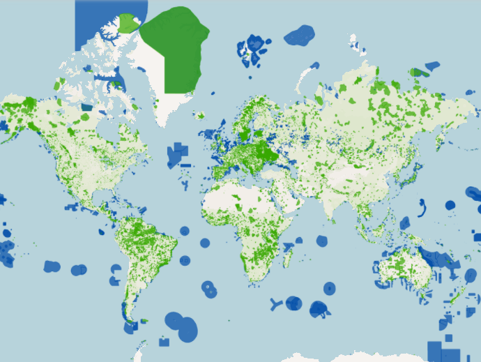
Protected Planet
Protected Planet, a project by the United Nations Environment Programme World Conservation Monitoring Centre (UNEP-WCMC), stands as a comprehensive data source dedicated to mapping and tracking the world's protected areas.
Offering detailed information on national parks, wildlife reserves, and other conservation areas, Protected Planet provides a crucial lens into global efforts to safeguard biodiversity.
The platform aids researchers, policymakers, and conservationists in assessing the effectiveness of conservation initiatives, tracking progress towards international conservation targets, and promoting transparency in environmental governance.
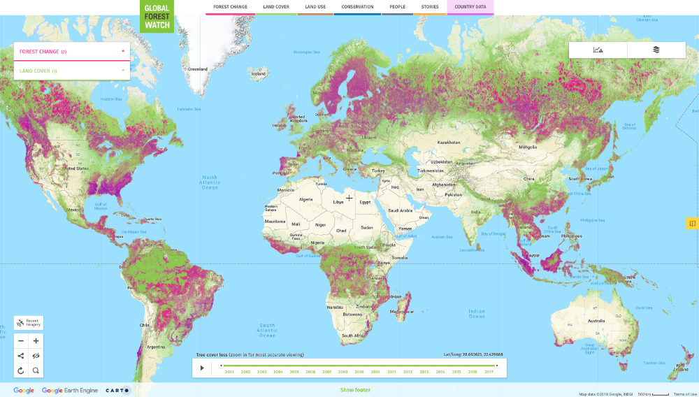
Global Forest Watch
Global Forest Watch, an initiative by the World Resources Institute, serves as a pivotal data source for forest monitoring and conservation.
Through satellite technology, the platform provides information on deforestation, forest degradation, and land-use changes worldwide. Global Forest Watch empowers a diverse range of users, including researchers, policymakers, and local communities, to track and analyze forest trends.
By offering transparent and up-to-date data, this platform not only raises awareness about the critical state of Earth's forests but also facilitates informed decision-making for sustainable land management and biodiversity conservation efforts on a global scale.
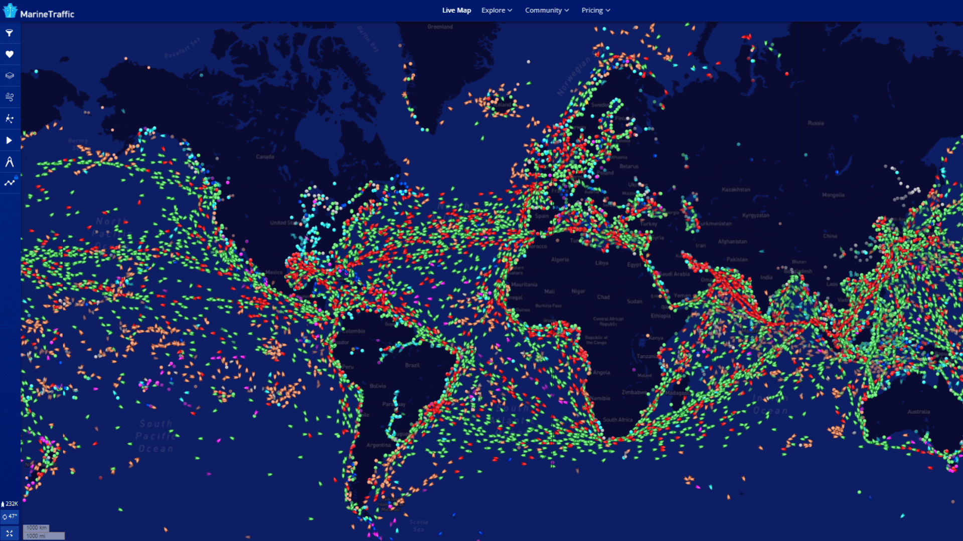
MarineTraffic
Specific for maritime activities, MarineTraffic emerges as a vital data source, providing real-time information on the movements of vessels across the globe.
By leveraging Automatic Identification System (AIS) signals, this platform offers a comprehensive view of maritime traffic, enabling users to track ships, monitor shipping routes, and gather insights into global shipping patterns.
Serving diverse sectors, from shipping companies and port authorities to environmental researchers, MarineTraffic contributes to enhanced maritime safety, efficient logistics, and the study of human impacts on the world's oceans.
Region-specific Data
The section on region-specific Data delves into repositories that zoom in on specific geographical areas, providing localized insights crucial for addressing environmental challenges.
North America
Dive into the vast datasets from the United States Geological Survey (USGS) and Natural Resources Canada (NRCan). They bring you everything from geological layers to hydrographic data, crucial for any project on North American soil.

Europe
Navigate the landscape of European renewable energy with the INSPIRE Geoportal and Copernicus Open Access Hub. These repositories offer a detailed look at the environment through top-notch satellite imagery and data, ensuring your project aligns with the European green vision.
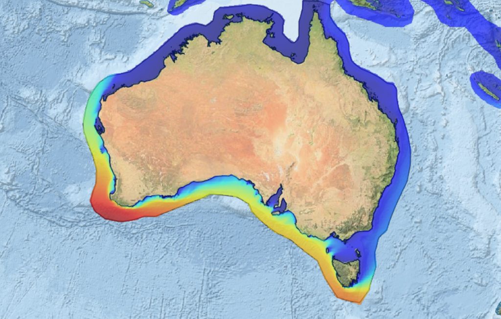
Asia-Pacific
Explore the dynamic Asia-Pacific region with resources like the Asia-Pacific Energy Portal and Australia’s AREMI platform. They provide a wealth of info on renewable resources that can propel your project in this diverse and rapidly developing area.
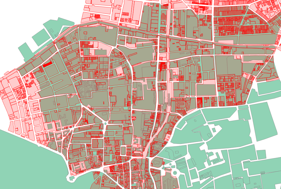
OpenStreetMap - Community-driven Data
OpenStreetMap (OSM) stands as a remarkable data source of geospatial information.
Driven by a global community of mappers, this collaborative platform offers detailed and freely accessible data, allowing users to explore and contribute to a wealth of geographic data.
From city streets to remote landscapes, OSM serves as a versatile resource for diverse applications, including urban planning, disaster response, and environmental analysis.
BONUS: Explore Atlas’ easy-to-use OpenStreetMap Integration to import data to your maps within seconds.
Utilize Environmental Data
Thanks to Atlas - the most powerful GIS tool in the browser, leveraging environmental data has become more accessible than ever.
Our user-friendly interface, allowing individuals, researchers, and decision-makers to explore, analyze, and visualize environmental data seamlessly.
You can overlay diverse datasets, such as climate information, land cover, or biodiversity indices, onto interactive maps, providing a dynamic and comprehensive view of the Earth's systems. Atlas come equipped with a range of analytical tools, enabling you to perform spatial analyses and extract valuable insights.
This approach facilitates collaborative efforts, as stakeholders can access and work with environmental data, promoting informed decision-making for sustainable practices, land management, and conservation efforts. Whether for educational purposes, research endeavors, or practical applications, these platforms democratize access to environmental data, fostering a more connected and informed global community.
And the best news? You can sign up and try Atlas for free: Sign up