Showcase
Check out these Atlas powered best-practice maps
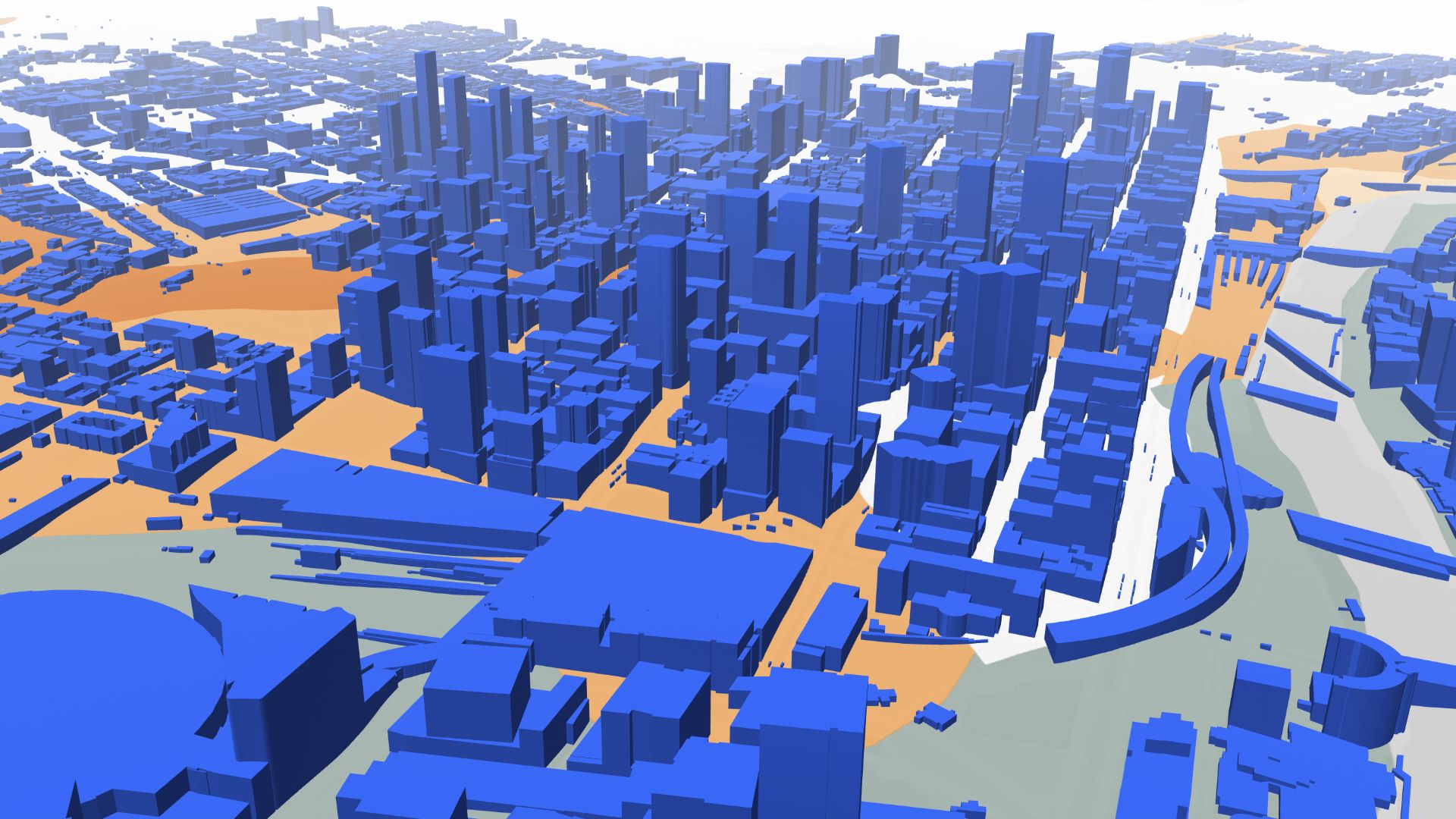
City of Melbourne in 3D
Map showcases Melbourne in immersive 3D, offering a spatial view of city structures and landscapes
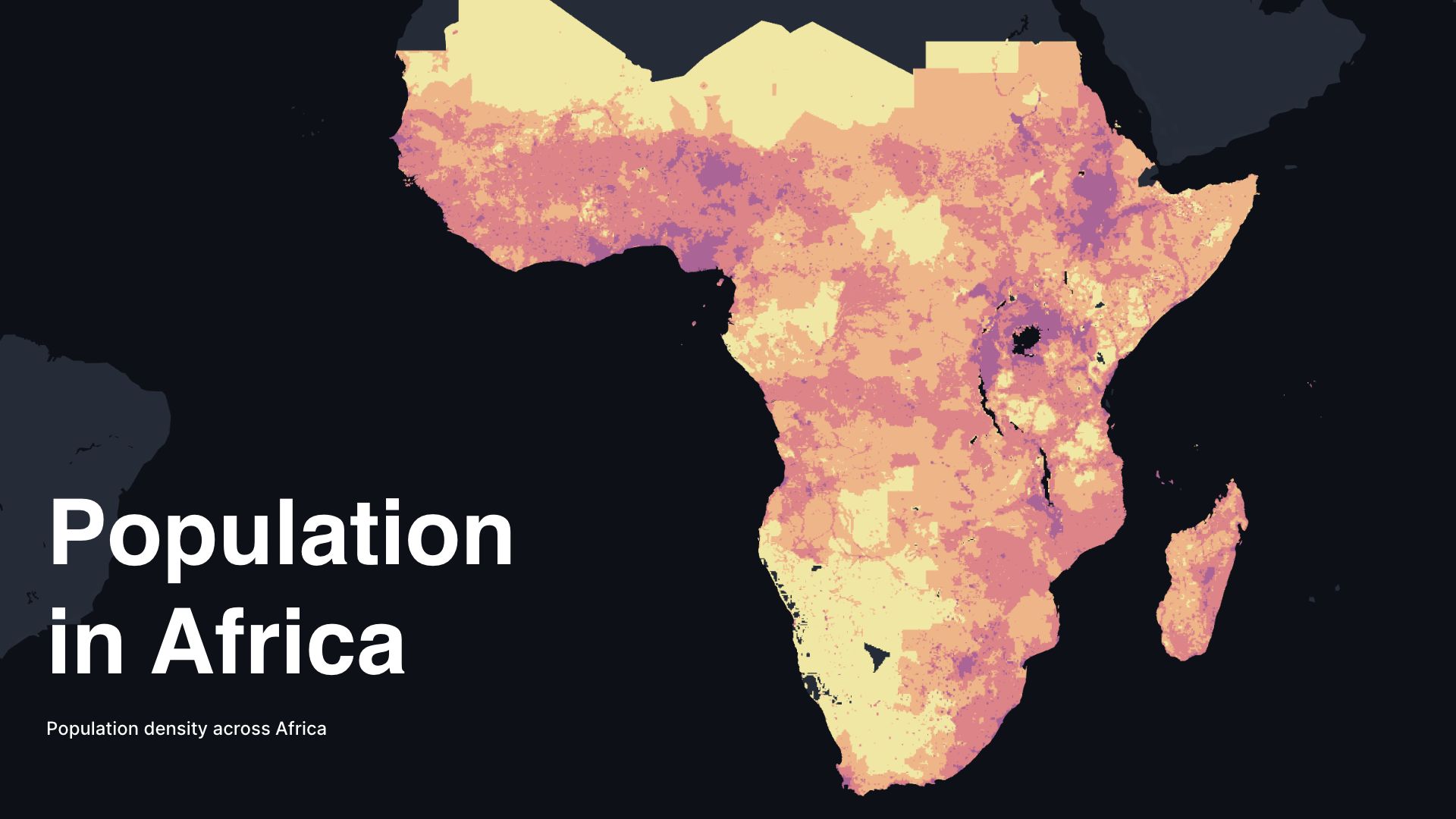
Population in Africa
Map displays population distribution in Africa, highlighting demographic trends and concentrations across the continent
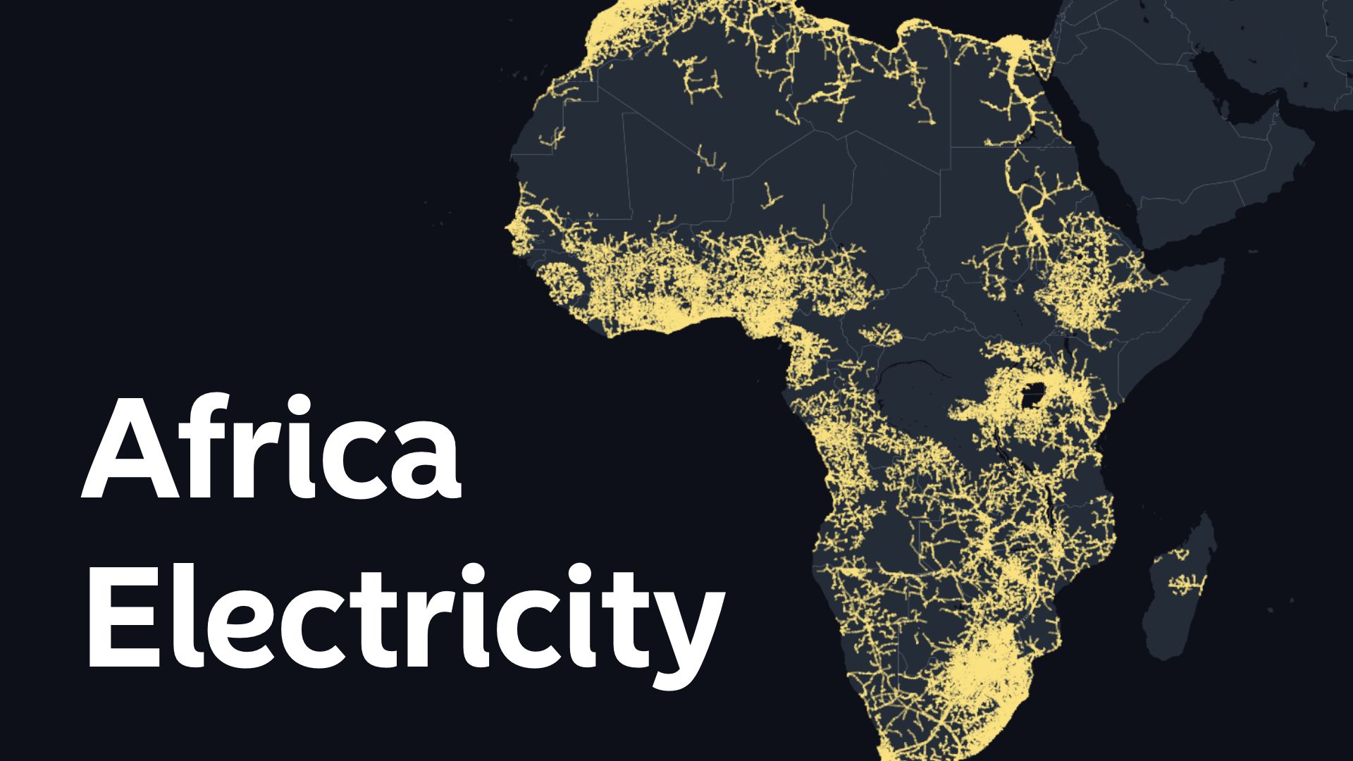
Africa Electricity Grid
Map illustrates the Africa electricity grid, showcasing interconnected networks and energy distribution infrastructure across the continent
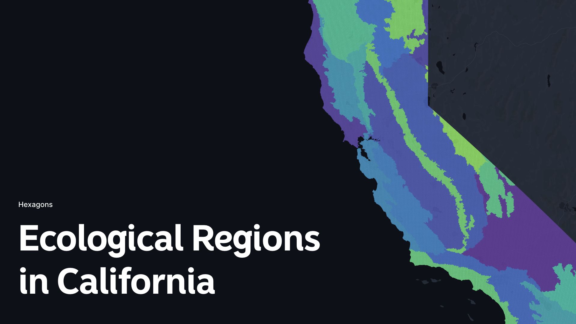
Ecological Regions in California
Map delineates ecological regions in California, showcasing diverse habitats and ecosystems across the state
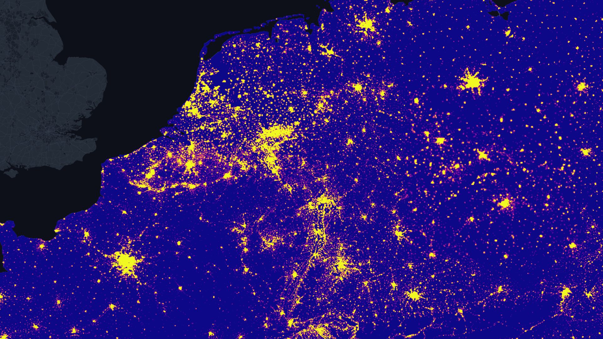
Population Density in Europe
Map delineates population density in Europe, illustrating concentrations and variations across diverse regions and countries
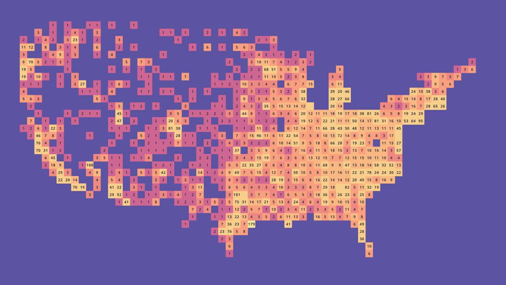
Counted McDonald's Stores in US
Map tallies McDonald's stores in the US, providing a visual representation of the popular fast-food chain's distribution
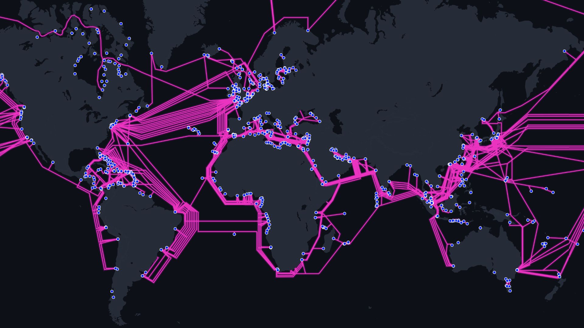
Global Submarine Cables
Map highlights global submarine cables, critical for international communication and data transmission across continents
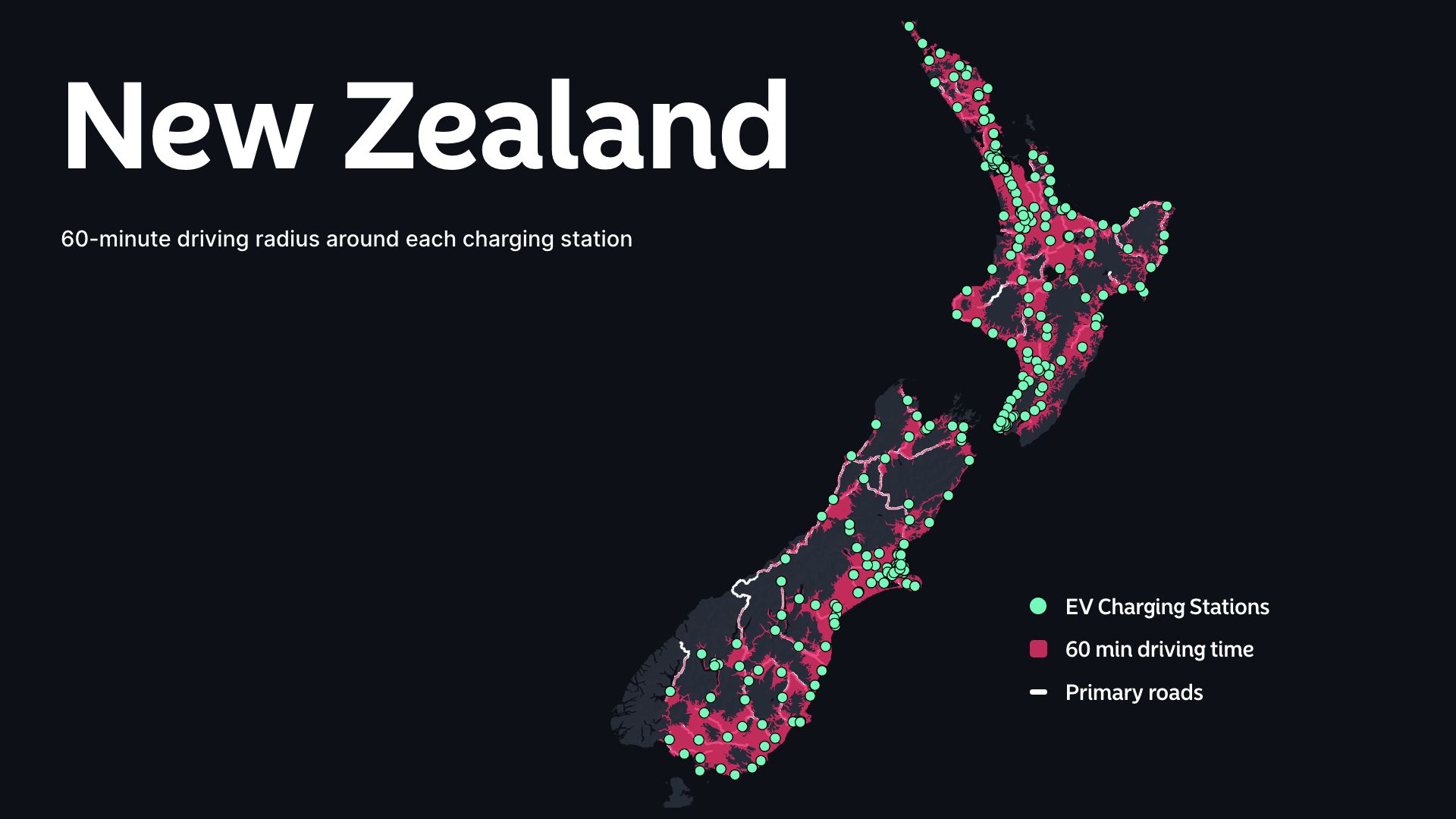
EV Charging Stations in New Zealand
Map displays EV charging stations in New Zealand, promoting sustainable transport infrastructure for electric vehicles

Vienna City Marathon
Map outlines Vienna City Marathon route, capturing the scenic course through iconic landmarks for runners
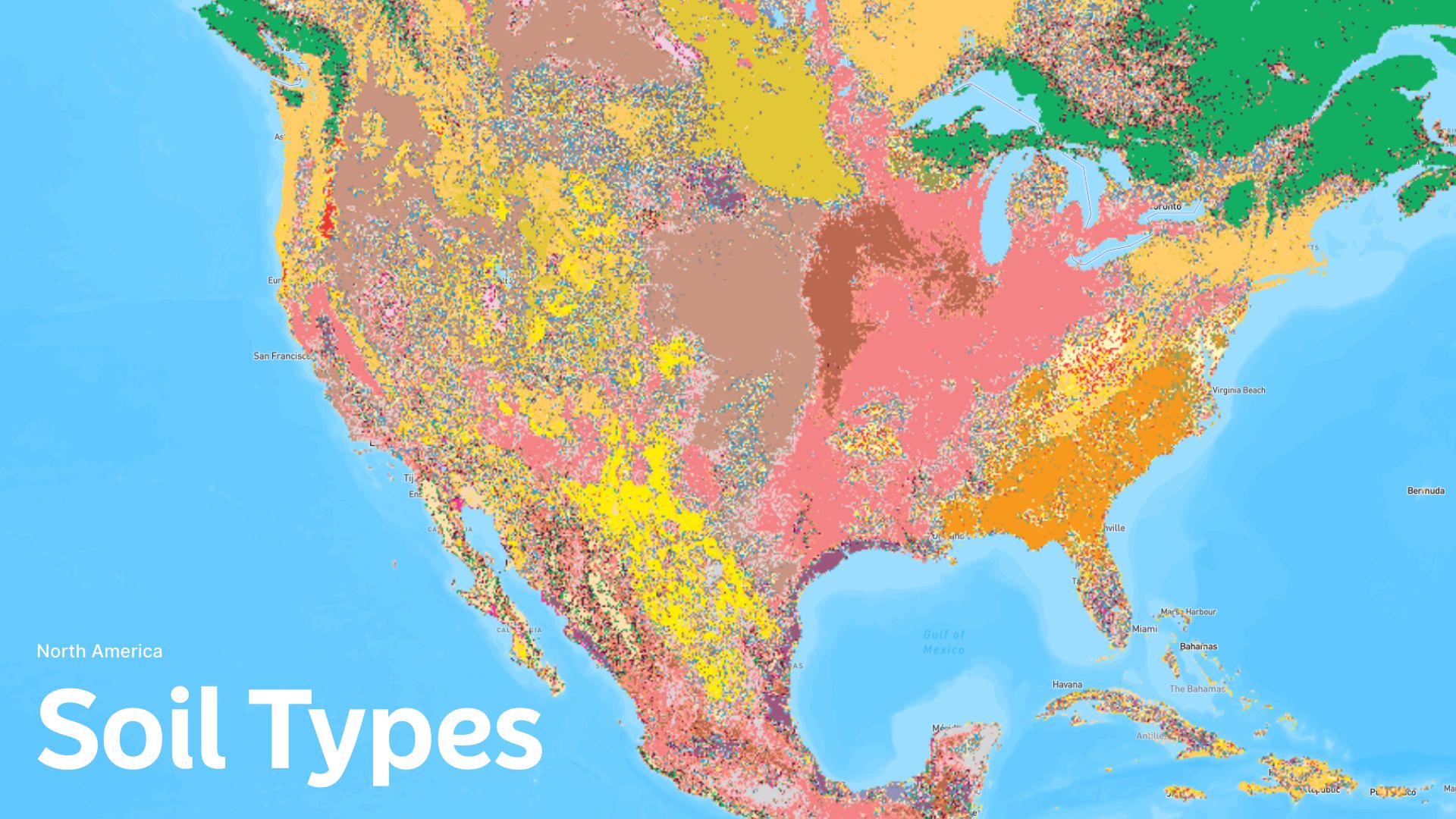
Soil Types in North America
Map categorizes soil types in North America, providing essential data for agriculture, conservation, and land management

21st Century Silk Road
Map outlines the 21st Century Silk Road, showcasing modern trade routes, connecting nations for economic collaboration
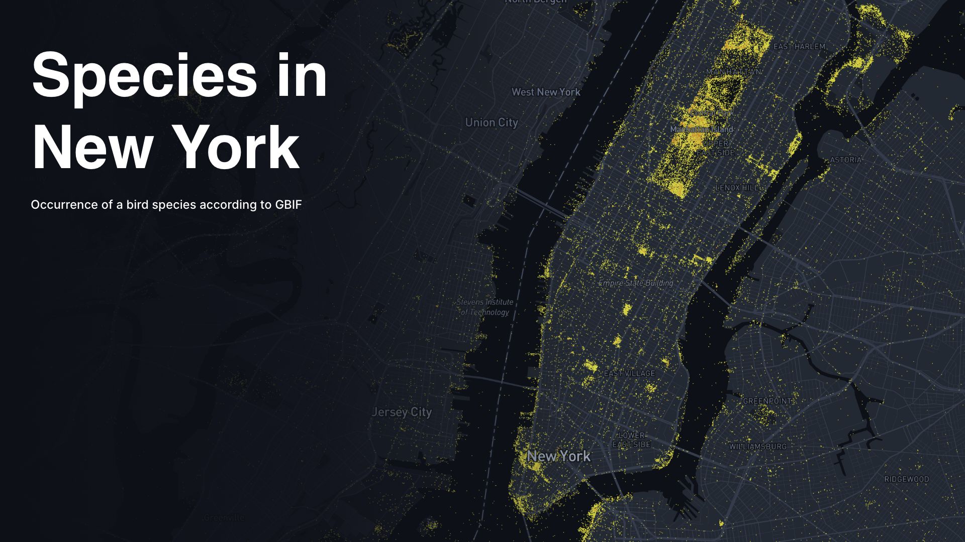
Species in New York
Map illustrates bird density in New York, offering insights into urban ecology and avian habitats
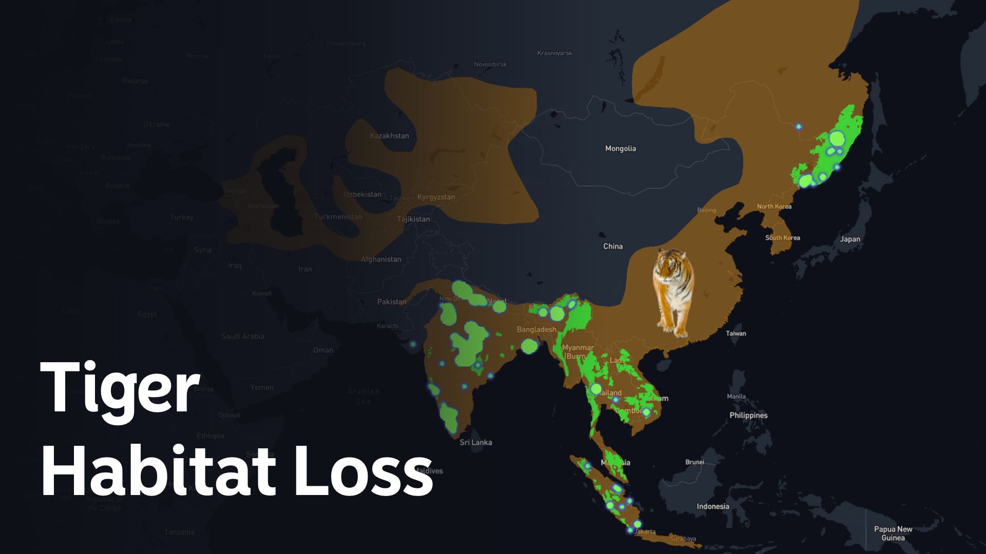
Tiger Habitat Loss
Map delineates alarming tiger habitat loss, emphasizing urgent conservation needs and the impact on ecosystems
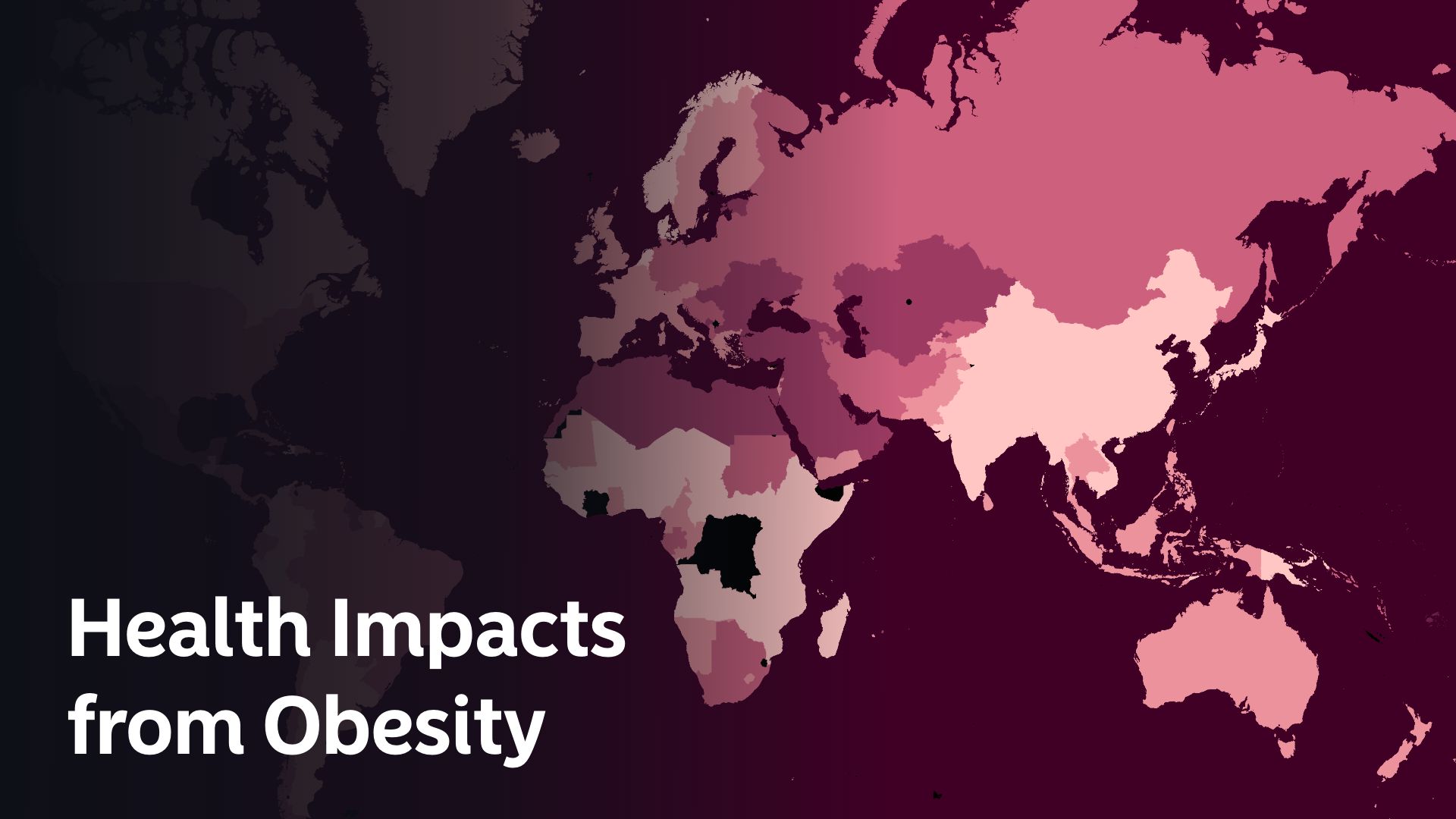
Health Impacts from Obesity
Map visualizes global health impacts from obesity, indicating prevalence and associated risks for informed interventions
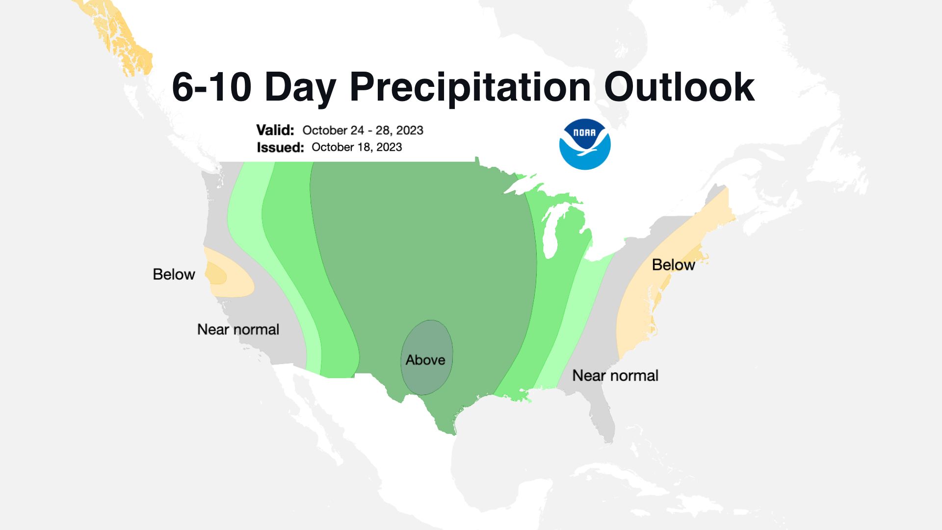
U.S Temperature and Precipitation 6-10 Day Outlooks
Map projects U.S. temperature and precipitation outlooks for the next 6-10 days, aiding weather preparedness
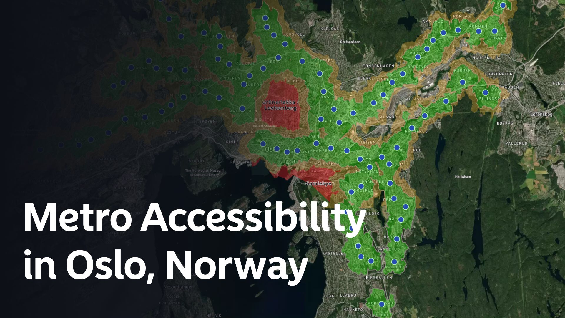
T-bane tilgjengelighet i Oslo
Map depicts T-bane (metro) accessibility in Oslo, presenting key transportation data for urban planning and navigation
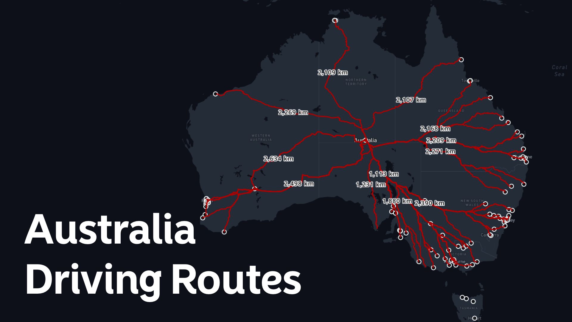
Australia Driving Routes
Map outlines driving routes in Australia, facilitating navigation and highlighting scenic journeys across the continent
