
We’re exciting to announce the launch of the Travel Time Analysis!
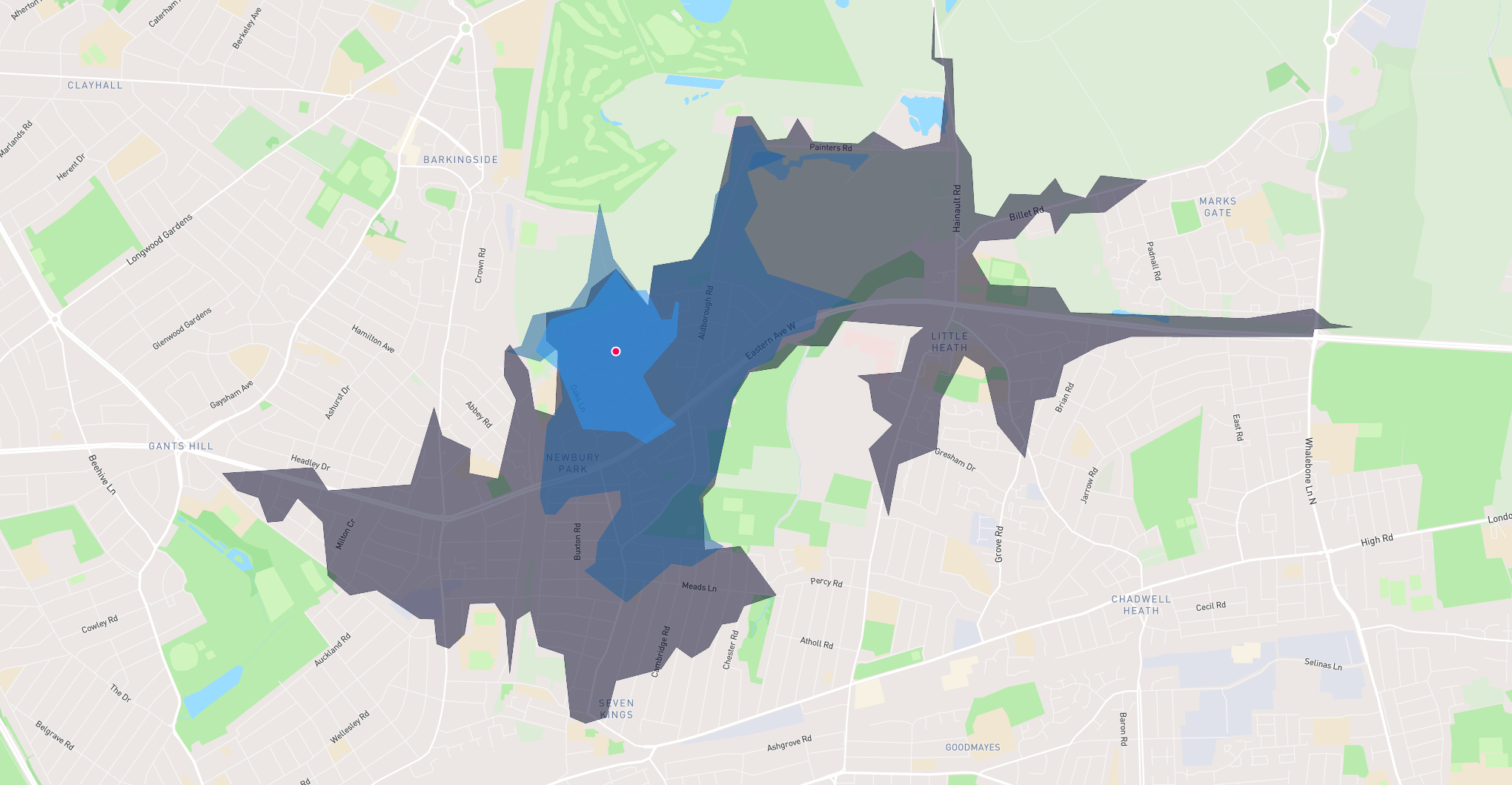
The Travel Time Analysis calculates the area that can be reached within a specified travel time along a street network based on travel mode.
What’s a Travel Time Analysis?
When it comes to location analysis, travel time analysis plays a crucial role. Whether it’s assessing the value of real estate, identifying the right retail location or planning the future transport developments, analyzing travel time can bring to light valuable insights and help to make important business decisions.
Use Cases
The Travel Time Analysis is designed to make it easy for any person to access, analyze and visualize travel time data. With our analysis, you can easily perform analysis for:
- Calculating the value of a property: You can use travel time as part of your geospatial analysis to assess how travel times impact the value of a commercial or residential property. This could include, for example, calculating the proximity of a property to key amenities like schools, gyms or public transport links.
- Assessing the impact of a new office location on employee commute times: If you’re planning an office move or expanding to a new office location, you can use travel time analysis to assess how far employees will need to travel to work. By analyzing employee travel times for a set of potential office locations, you could then select the office location that would be the most convenient for staff.
- Choosing the right store location: When it comes to choosing the location for a new store, travel time analysis can help retailers identify the area with the best accessibility for customers. Layered with demographic data, you could also analyse the reachable population within a particular area, using these insights to then select the best store location.
Travel Modes
- Walking: Follows paths and roads that allow pedestrian traffic and finds solutions that optimize travel time. The walking speed is set to 5 kilometers per hour.
- Cycling: Follows preferred paths and streets for bicycling and finds solutions that optimize travel time.
- Driving: Models the movement of cars and other similar small automobiles, such as pickup trucks, and finds solutions that optimize travel distance. Travel obeys one-way roads, avoids illegal turns, and follows other rules that are specific to cars.
- Driving with traffic: Models factors in current and historic traffic conditions to avoid slowdowns.

Analyze Travel Time
To perform an Travel Time Analysis, complete the following steps:
- Find the Travel Time Analysis under the Analysis tab
- Select the input data, choose between selected features or a complete dataset
- Select travel times, between 1 and 60 minutes
- Select Travel Mode
- Click Run
After a few seconds the output is displayed in the map as a polygon layer.
Tips and Tricks
- When you run travel time analysis on several points that are located near each other, the travel time polygon will overlap each other, making it difficult to read the data. Luckily, you can easily select all of the travel time polygons and dissolve them into a single geometry!
Want to Try it Out?
We invite you to explore the power of Travel Time Analysis. Whether you're a GIS expert, an environmental enthusiast, or a professional navigating urban development, this feature is here to revolutionize the way you interact with maps.
Welcome to a new era of map interaction!

